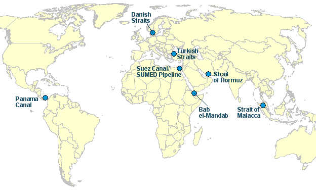
The following article is focuseto promoting awareness of various “choking points” around the world. Choking points are straits -narrow corridors of water connecting two large bodies of water. They are, however, different in terms of their intrinsic value to global trade. Much of the world’s trading goods, and in particular oil, is transported along these straits and if they were to shut down for any reason , this would lead to a major disruption of trade of goods.
There is a total of seven choking points in the world. The following is a description of each of them:
Strait of Hormuz:
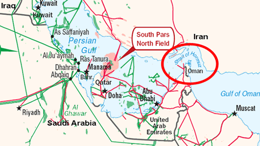
Situated between Iran and Oman, the Strait of Hormuz connects the Persian Gulf with the Arabian Sea. It is perhaps the most vital choking point because some of the world’s major oil producing nations (Iraq, Kuwait, Saudi Arabia, United Arab Emirates) rely on it to transport oil.
In 2011, the strait of Hormuz was a popular topic in the news. Iran threatened to close the strait in response to the crippling sanctions being imposed on the country with regards to its nuclear program.
US presence along the strait was established in 1991 during the first Gulf War and it continues to maintain a naval presence in order to ensure the free flow of oil from the region.
Strait of Malacca:
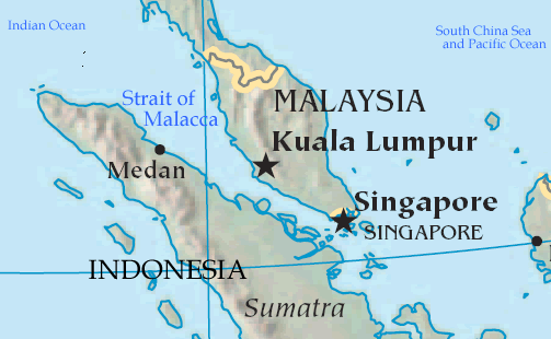
The Strait of Malacca is situated between Singapore, Malaysia, and Indonesia. It connects the Indian Ocean with the South China Sea and the Pacific Ocean. All of the oil transported from the Persian Gulf to the Asian markets (particularly, China and Japan) goes through the Strait of Malacca. If the strait were closed down, half of the world’s trading vessels would be forced to use an alternative (and a longer) route.
Bosphorus and Dardanelles (Turkish Straits):
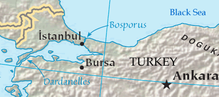
The Bosporus and Dardanelles also known as the Turkish Straits is in Turkey. The Bosporus is situated between the Black Sea and the Sea of Marmara whereas the Dardanelles is situated between the Sea of Marmara and the Aegean Sea. It is considered to be the most dangerous chokepoint in the world because it is a mere 800m wide at its narrowest point with many sharp bends, thus making navigation extremely difficult.
Nearly all the shipments navigated through the Turkish Straits contain oil from the Caspian Sea region. It is also Russia’s primary route to access European markets. It is interesting to note that Turkey must allow free passage to non-military vessels of countries with which it is not at war. in accordance to an agreement signed in 1936 called the Montreux Convention Regarding the Regime of the Straits.
Suez Canal:
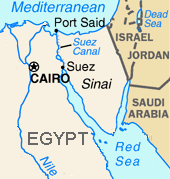
Arguably, one of thebusiest straits, the Suez Canal is located in Egypt and was built in 1869 in order to to connect the Mediterranean sea with the Red Sea, allowing vessels to travel through Egypt rather than around Africa, thus reducing the distance travelled between Europe and Asia.
In 1956, the Suez Canal was shut down due to Israeli forces invading the Sinai peninsula (which was a response to Egypt’s nationalization of the canal), but eventually Egypt was given control over the Canal. Since then, Egypt has used the Suez Canal as a counterweight against threats to its sovereignty on a handful of occasions, particularly in the 60s and 70s when tensions between Egypt and Israel were high.
The canal is a vital route for oil tankers from the Persian Gulf going to Europe and North America. If it were to close down, oil tankers would be forced to travel around Africa.
Bab el-Mandeb:
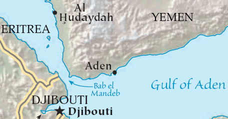
Bab el-Mandeb is to the south of the Suez Canal, separating the Red Sea and the Gulf of Aden (between Djibouti, Eritrea, and Yemen). Any vessel that goes through the Suez Canal must also go through Bab el-Mandeb, thus the two are interdependent.
Due to rising issue of piracy, there has been much concern about security in the area.
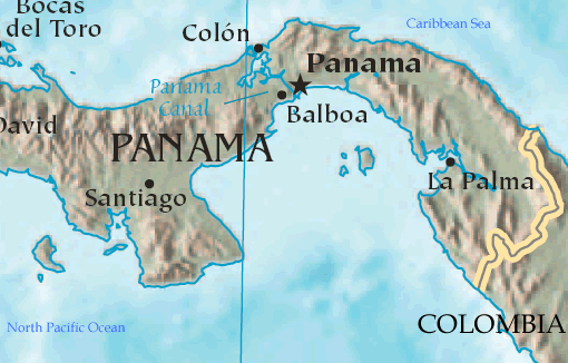
Panama Canal:
The Panama Canal connects the Pacific and the Atlantic Ocean. 60% of American trade coast-to-coast trade relies on the canal. Furthermore, the country’s global trade also depends on the canal. If the Canal were to be closed, vessels would have to be rerouted around South America, thus adding 13000 kilometers to their journey.

